

Where we went and why
We went on an unplanned walk today. We normally plan a walk at least a few days before, but this morning, my hubby asked if I wanted to go for a walk. I said that sounded like a good idea and asked where he wanted to go. That was around 8:00 AM. We didn't leave the house until after 12:30 PM. We couldn't seem to come to a conclusion on if we were going to go or not go. Once we decided we were going to go, we couldn't decide where we were going to go. At some point, I thought we had agreed to Suttle Lake, but then as we were leaving, hubby said that we were going to the Deschutes River Trail. As part of our discussion on where to go, I looked up the map and we discovered that the only part we hadn't done yet was too long of a hike for today, so he said that we were just going to do a section that we had already done. He picked it because it was flat.
The walk
Once we got to Bend, we realized that it was Pole, Peddle, Paddle Day and we were taking a walk right in the heart of it. We planned on doing the middle loop section in the map above. You can see a bridge going across the vertical section of the river and another going across the horizontal section. We parked in the Old Mill District. It was madness! We managed to find a parking space, but only because we followed someone to their car. We started off near the first bridge, but discovered that the other side of the river is where the running part of the Pole, Peddle, Paddle was being help, so we decided to say on the Old Mill side of the river. We went left this time.
The first section of the walk is paved with bricks. It's a nice flat walk that follows the river. There are some grassy areas on the other side of the path. There were people playing frisbee and others just laying in the grass. I don't know how cozy I would get in the grass because there are a lot of geese who use the same grass as their bathroom. There are benches along the way and some interesting artwork. I liked all of the flowers that were there. It was a nice day for a walk. it wasn't too hot, and there was a gentle breeze.

Once we got to the next bridge, we decided to keep walking. Eventually the brick walkway turned into a dirt path. It was still pretty level, but there were some rocks in the path. The trail stayed along the river and it was pretty wild that you magically went from a park in the city to a path in the woods. The path was pretty wide when it was just on it, but there were also bicyclists which magically made the path very narrow. We had to pull off in order to let them pass. They were all very appreciative of us getting out of their way.

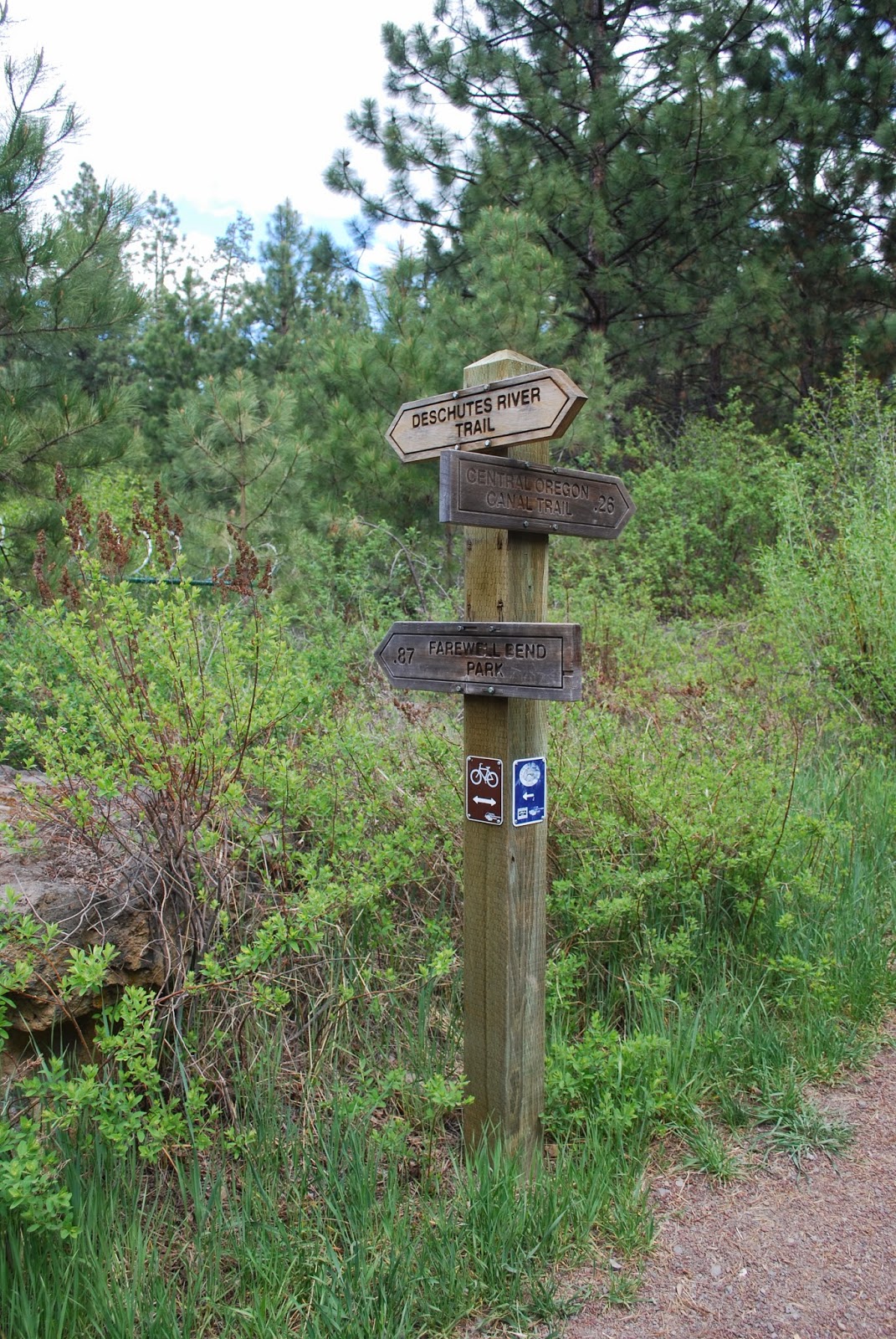
If we had kept going, we would have made it to another bridge over the river, but we turned around before that point. We made it to a sign post that indicated that we were .87 miles from Farewell Bend Park. I think that's the park near the bridge that would have been the bridge we would have gone over had it not been for Pole, Peddle, Paddle.
Overall thoughts
I like the walk. It was easy enough even though i'm 297 pounds. it was nice flat terrain with some little tiny ups and downs. I didn't seen any bathrooms along the way, but I'm sure you could find one in the Old Mill District. The last time we were out on this trail, it was March 13. I remember having some lower back pain and being out of breath for most of the walk. We only did 1.3 miles that day, and I remember being pretty tired by the time I got to the car. Today, we did a longer hike. However, I don't know how many miles since my phone died, but I wasn't tired when we were done. My feet were sore, but I wasn't tired. I'm pretty happy with that. I've been getting a bit bummed that I'm not losing weight, but things like this make me realize that I'm getting stronger even if I'm not getting smaller.

BodyMedia Screen Shot
I took my phone and set up MapMyHike and my BodyMedia workout tab, but the phone died at some point after the 37 minute mark. That was the last time that I looked at my phone. I still have the screen shot from the website, but I was really hoping for the workout tab to show how many calories I burned and how many miles MapMyHike showed. I was pretty excited to see that I was up to 14 calories per minute towards the end. It was slower in the beginning because I stopped more to take pictures.

If you like the pictures, watch the video
I love to take pictures and usually take way more on a walk than will fit into the blog. I'm going to make videos of all of the pictures from the walks and post them on YouTube. If you'd like to see more of the pictures from this walk, you can see them in the video!
No comments:
Post a Comment